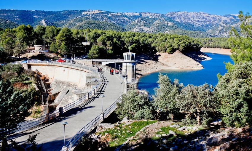
Guadalentin River
The Guadalentin river flows for 121 kilometres along the valley of the same name, in the Region of Murcia. It is also known as the Sangonera river. It is born in the so-called Puentes swamp, feeding on the convergence of the Corneros, Luchena, and Turrilla rivers.
From there, it takes a southeast direction and passes through the urban area of the city of Lorca, then continues through the vast Guadalentin valley, receiving the river bed of the Rambla de Nogalte. Later, it turns to the northeast, covering areas of the municipalities of Totana, Librilla, and Alhama de Murcia, where it takes significant contributions from other ravines.
In the hamlet of Pareton in Totana, the Guadalentin river has two channels: one that will take its waters if it comes excessively loaded by the Rambla de las Moreras, in the town of Mazarron, and that leads directly to the Mediterranean Sea; and the other, already in the municipality of Murcia, which consists of an artificial channel called the Requeron channel that connects it to the Segura river, thus becoming the main tributary of this river on the right bank.

The Guadalentin river is distinguished by its unpredictable nature, with a poor flow that in a few hours can increase considerably. Almost always, its channel—very shallow but quite wide—contains only a small stream of water that would normally follow this channel, but these waters are now retained in the Puentes swamp for its use.
The few waters of the Guadalentin river are down-regulated by the “Real Acequia de Alcala” to irrigate the orchards of Lorca, located in the wide extension that goes from Tercia to the town of Sutullena and from Marchena to the town of Tamarchete.
The few waters of the Guadalentin river are down-regulated by the “Real Acequia de Alcala” to irrigate the orchards of Lorca, located in the wide extension that goes from Tercia to the town of Sutullena and from Marchena to the town of Tamarchete.
However, it is estimated that this river has had, throughout its history, floods that could have reached 3,000 cubic meters per second, fed by torrential rains and the discharge of its ravines, which created spectacular flows that, unfortunately, caused great damage. The history of the river includes 65 floods.
In the past century, for example, there were three great floods. The most serious of them was in October 1973, when the flow registered in Lorca was over 2,500 cubic meters. It should be noted that the water torrent contained a large amount of solid material due to the landslides and drag. The flood destroyed 3 kilometres of the main communication route with Murcia and the waters exceeded the height of an 8-meter-high bridge. Many of the municipal services, buildings, houses, and farms were lost. There were hectares of destroyed farmland and dozens of dead animals. In Lorca, 13 people died, while in Puerto Lumbreras, where the impact was greater, the number of people who died rose to 89.
In the present century, in September 2012, there was another serious manifestation of the torrential rains of the so-called Cold Drop or “Dana”—a meteorological phenomenon that generally coincides with the beginning of autumn and spring. This time, the avalanche of water and mud destroyed more than 300 houses and 260 farms, in addition to causing the loss of arable land and dozens of animals. In total, 13 people died.
However, the Guadalentin river is of environmental interest because it contains water birds and birds of prey that otherwise have little presence in the region. A highlight is the Montagu's harrier, a bird of prey that has gradually abandoned its already sporadic visits to this river. Among the waterfowl is the black-winged stilt, which has found its preferred breeding place in the river.


